EXAMPLE USAGE
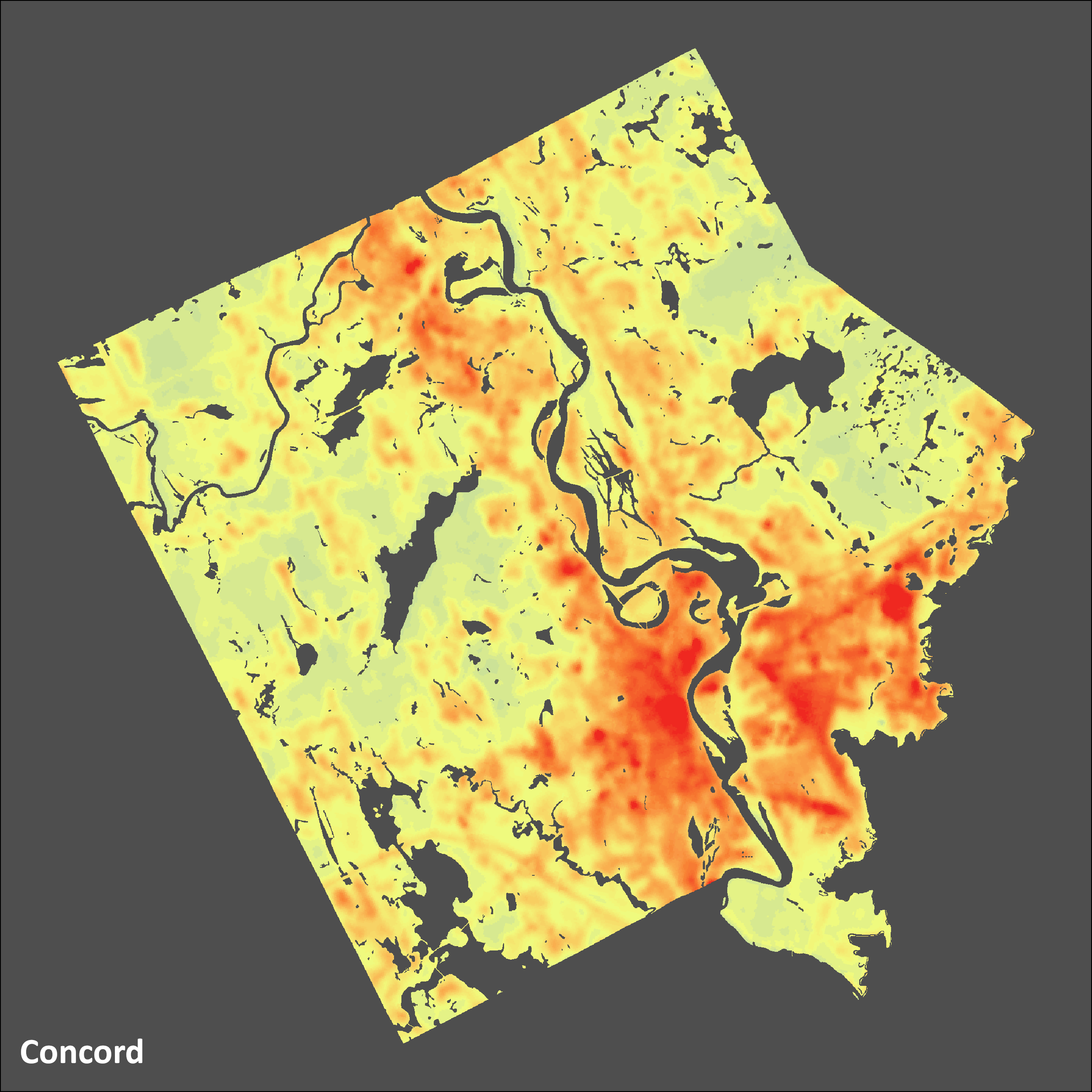
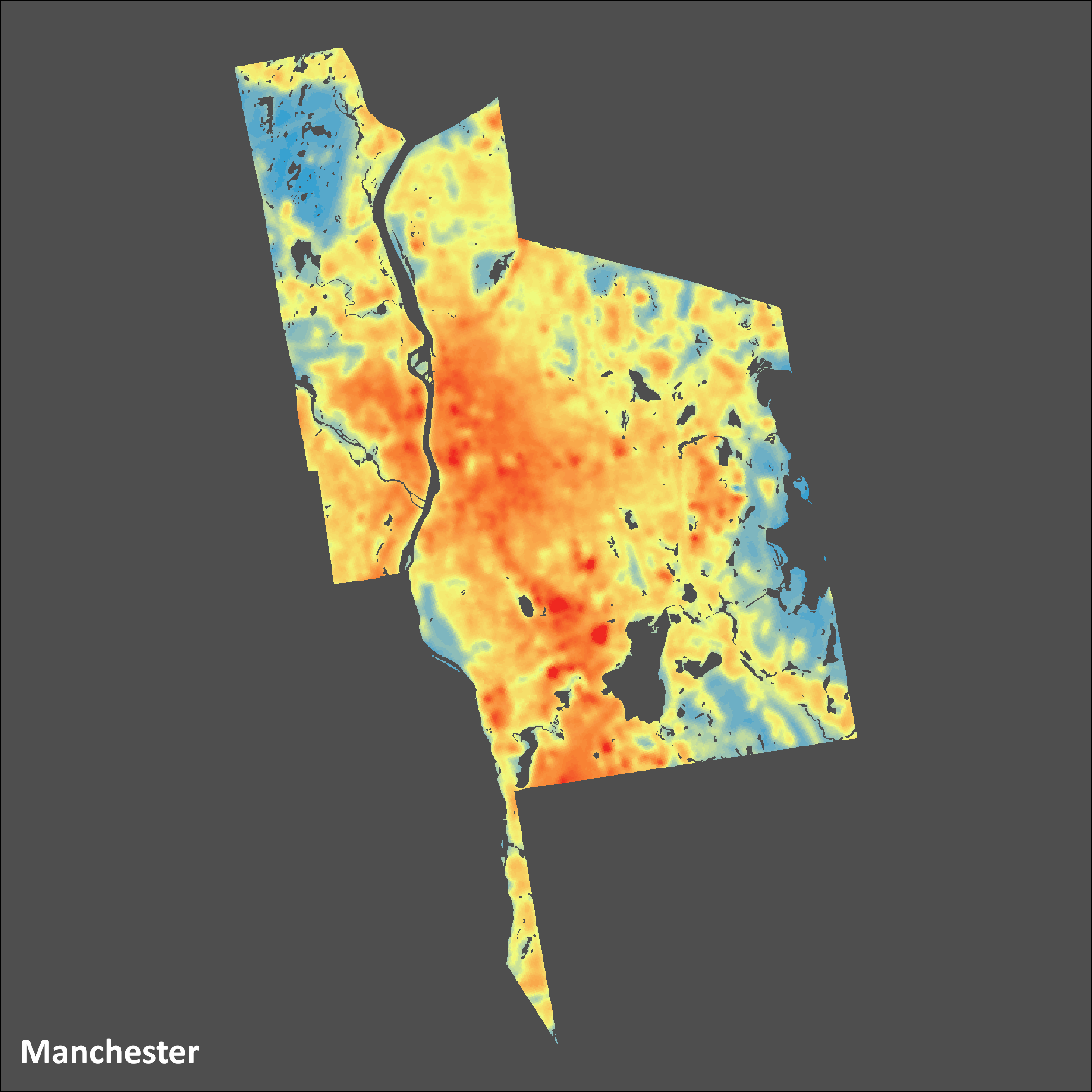
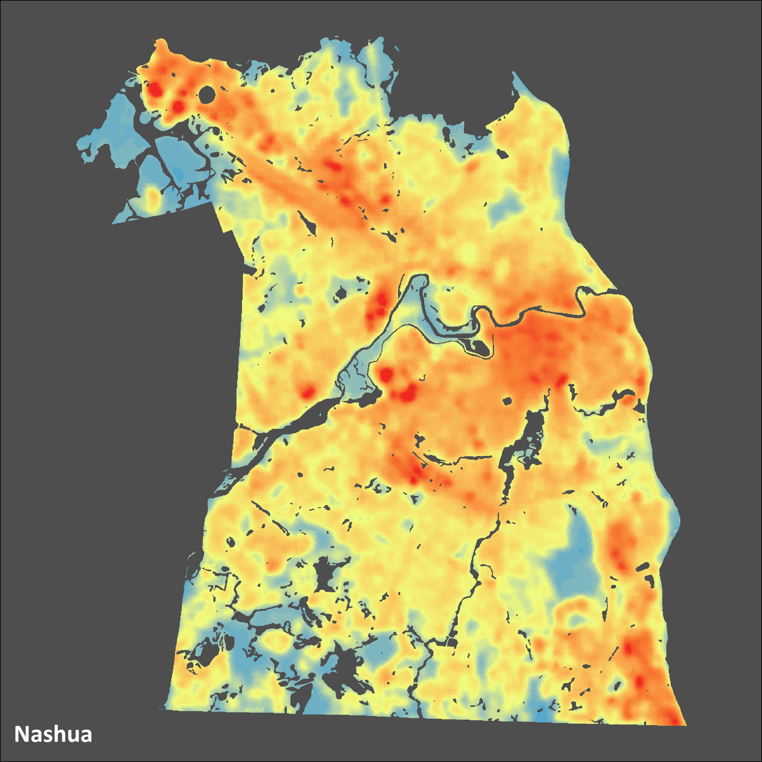
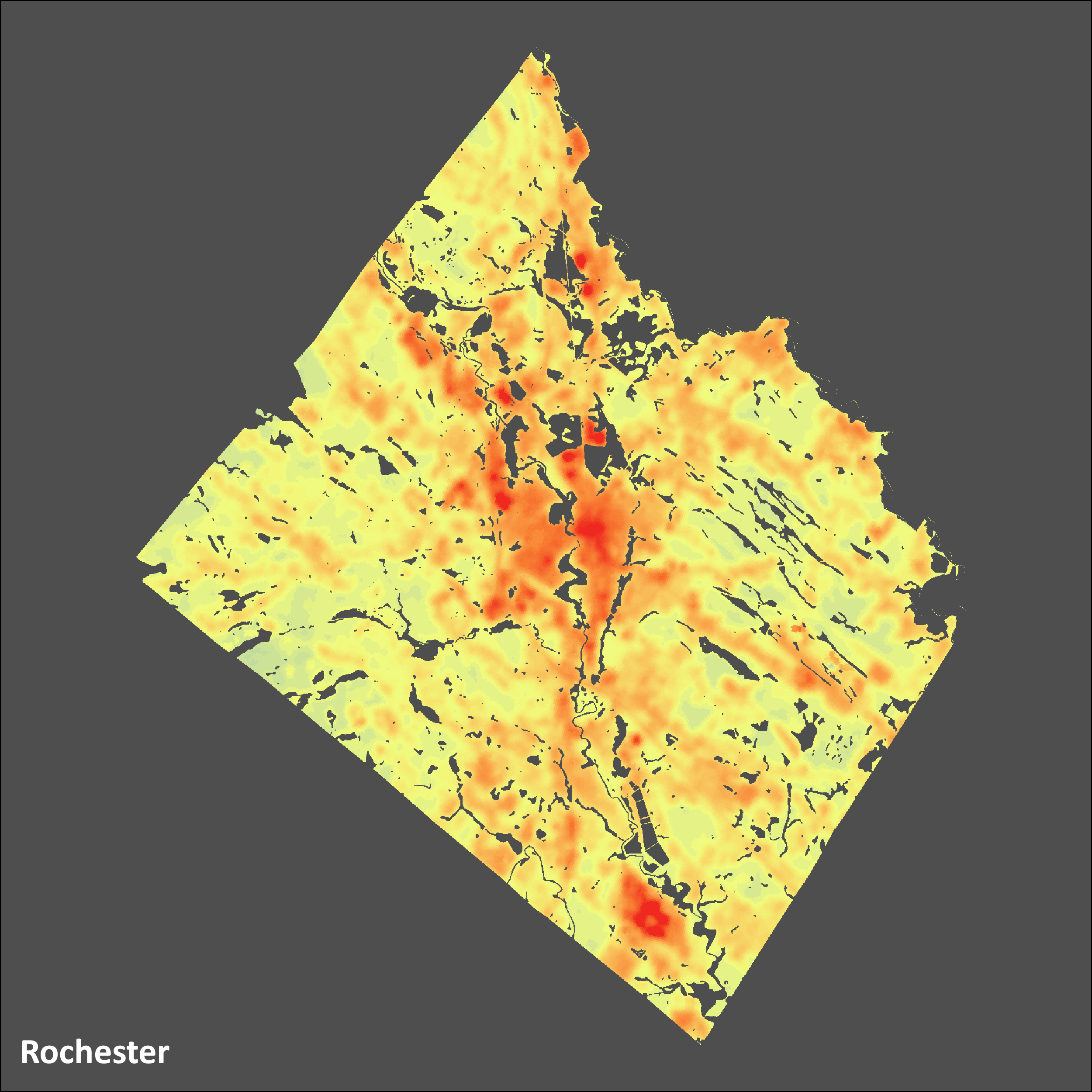
These geo-referenced image files show city-wide variation in mid-summer land surface temperatures for four NH cities: Concord, Manchester, Nashua, and Rochester.
The layer shows how much cooler or hotter each part of the city is relative to the citywide average. We made the layer for a project about heat-related illnesses, which was published in summer 2021.
We made this layer in ArcMap and ArcGIS Pro using analysis-ready data from USGS’s Landsat Provisional Surface Temperature dataset. First, we selected images for three cloudless days in July between 2015 and 2018, using the provided error layers to make sure data for our cities was as distortion-free as possible, and averaged the temperatures across those three days. Second, we removed water bodies to focus our calculations on land. Finally, to emphasize relative temperature differences within each city, we calculated each point’s deviation from the city-wide average temperature.
Type: Spatial
File: Raster (.tif)
Source: USGS
Last Updated: August 2021


